My route today (Fri., 8/18) took me from Fenton, MI (pop. 11,989) to St. Johns, MI (pop. 7,653), about 52 miles. I had about 30 miles to cover on roads, and then for the remaining 22 miles was on the Fred Meijer Clinton-Ionia-Shiawassee Bike Trail.
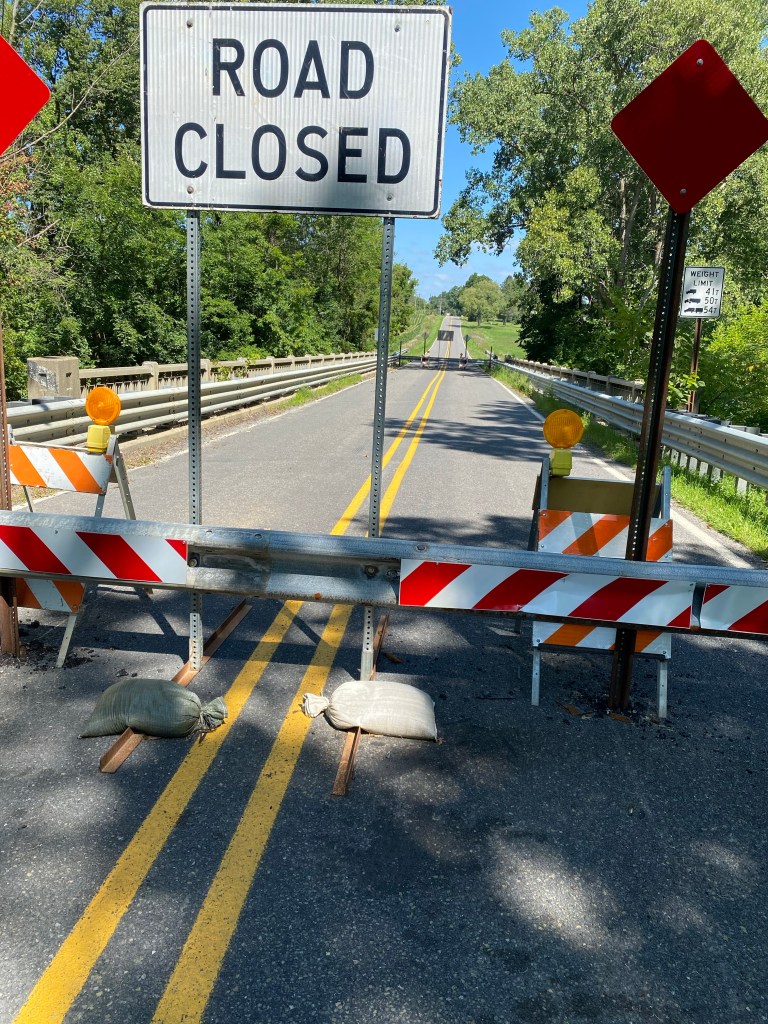
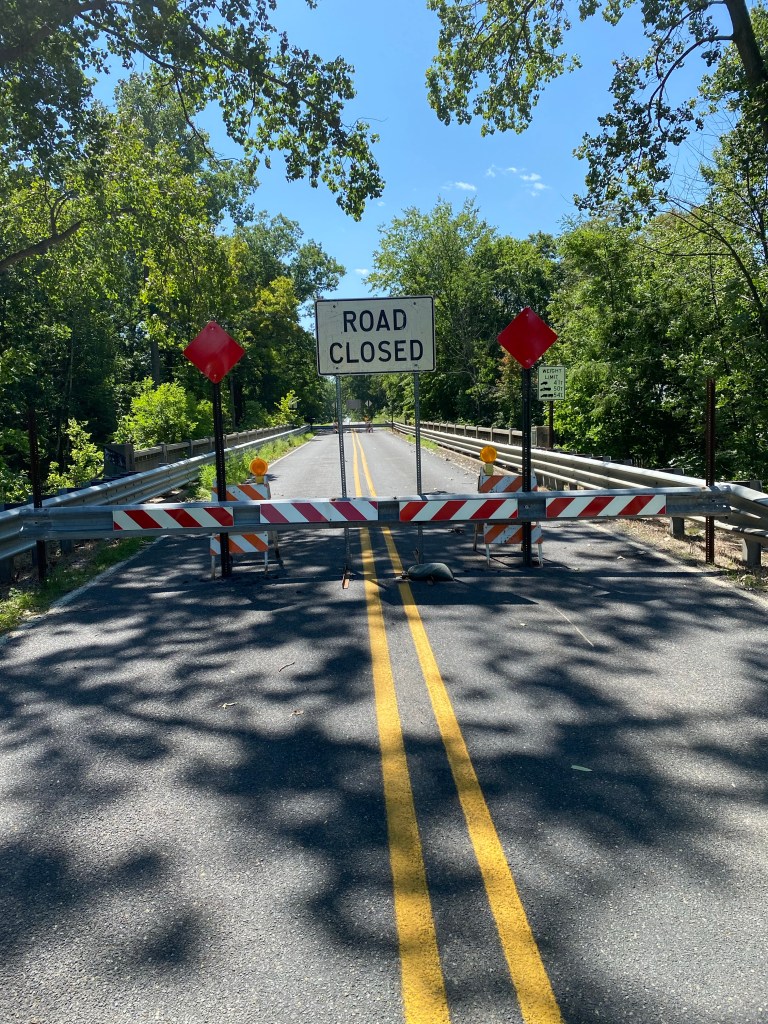
Before I got to the trail, I came to a sign in Byron, MI, advising me that a bridge on my route across the Shiawassee River was closed. And not only that, but there was a solid metal barrier about two feet high that completely blocked the roadway leading over the bridge–no room even for a bike to sneak through. I had a consultation with my Chief Navigator Trudi about necessary detours, and then I decided I wasn’t so interested in another detour to lengthen the day’s journey. Unlike yesterday’s bridge, this one– thankfully–hadn’t been demolished, and it looked safe enough to hold my bike and me. There didn’t appear to be anyone around to see what I was doing, so I unloaded the heavy packs from my bike and lifted it over the barrier and crossed the bridge. As I was making the crossing, I rehearsed what I might say if a law enforcement officer came by to ask me if I knew how to read. Mission accomplished–no detour was needed, and no one confronted me about my decision to ignore the road closure sign.
Here is what the road/bridge looked like heading west.
And here’s what it looked like from the other side.
In Byron, I learned that the town, founded in 1836, was named after the British poet, Lord Byron, and was a milling and agricultural supply center for the rich Shiawassee Valley. I learned this from a historical marker that also honored Ellen May Tower (1868-1896) who served as an army nurse in the Spanish American War, where 90% of American casualties were from disease. Nurse Tower herself died of typhoid fever in a hospital tent and received the first military funeral in Michigan for a woman.
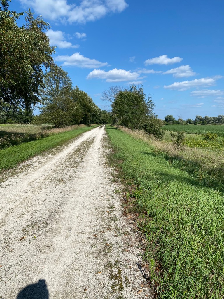
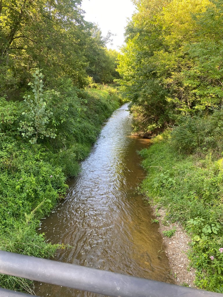
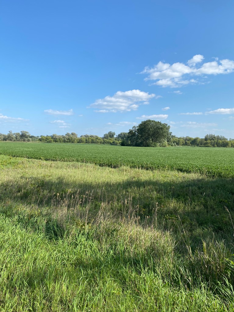
The Fred Meijer Clinton-Ionia-Shiawassee Trail stretches for almost 42 miles, from Owosso to Ionia, MI, and it connects with the Fred Meijer Grand River Valley Trail and other trail networks that extends its reach even further. I was on the trail from Owosso, MI to my hotel in St. Johns, MI, which was just a few blocks south of the trail. Most of the trail is crushed limestone which, depending on the section of the trail, was either a bit soft and only allowed me to go about 7-9 MPH, or more densely packed, allowing me to hit about 12 MPH. When it passes through towns, the trail is paved with asphalt, which made for even faster progress. Here are a few scenes from the trail, which passes through a lot of gorgeous farm country, and crosses a number of bridges over rivers and creeks–none of them closed.
It was fortuitous that the new route we needed to map to get to Muskegon, where the ferry service across Lake Michigan is still running (rather than Ludington, MI, where the ferry service has closed for the season for ramp repairs), took me through St. Johns, MI, which is where the Green family, immigrants from England, originally settled in 1849. I told my innkeeper, Ken Harris at the Heritage Place Hotel in St. Johns, about this and said the only relative I knew of who still lived in the area, Fred Green, had died in 2007. Fred was a fairly distant relative–his great-grandfather was a brother of my great-great grandfather. Fred used to operate a printing business on Clinton Ave., in the heart of downtown St. Johns just down the street from my hotel. Coincidentally, Ken said he knew Fred–Ken used to manage a restaurant across the street from Fred Green Printing and took all the restaurant’s printing business there.
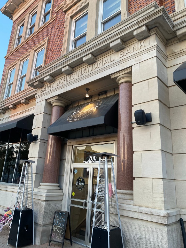
I had dinner tonight at the St. Johns Brewing Co. on Clinton Ave., less than a block from my hotel. The bar/restaurant is located in a building formerly occupied by the St. Johns National Bank, as you can see in this photo.
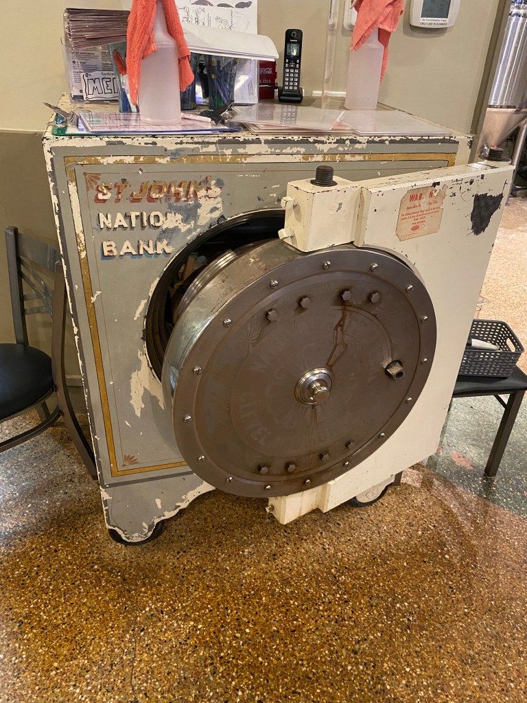
There is a safe used by the bank in the lobby of the restaurant, as you can see in this photo.
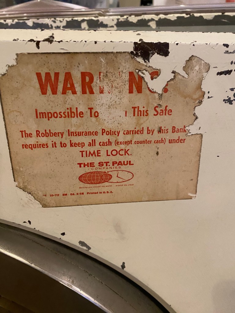
I thought this notice on the safe was interesting. Issued by The St. Paul Companies, it warns potential thieves that it is impossible for them to open the safe because the bank’s robbery insurance requires the safe to be on a time lock, restricting the times at which it can be opened.
My route tomorrow, Sat. 8/19, will be a long day of almost 60 miles to Grand Rapids, MI, but most of this will be on bike trails, so at least I won’t have to contend with traffic along the way.

Leave a comment