I left my motel in East Glacier at 7 a.m. yesterday (Sat., 6-15), anxious to make the final climb to the Continental Divide before the weather was supposed to deteriorate that afternoon. My weather app for the day said that there would be “severe weather,” including a “high wind warning,” beginning by about 2 p.m. Thankfully, I only had 12 miles to cover to reach the top of Marias Pass, but there would be more elevation gain, and I wasn’t sure what to expect. The route mostly lies between Glacier National Park and the Great Bear Wilderness.
This was one of the first signs I saw as I headed up to the pass on Hwy 2.
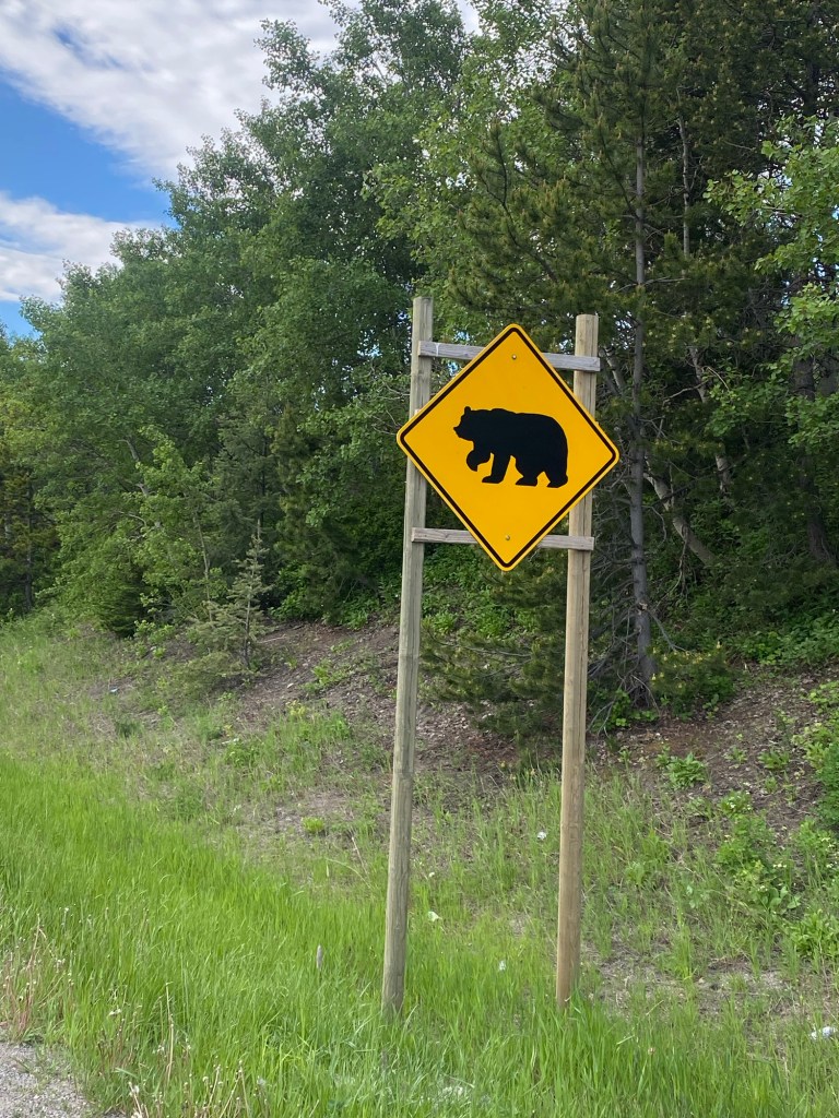
I had my bear spray in my front bike bag, but even after reading the directions on the can several times, I was dubious I would be able to use it to my advantage in a bear encounter. There were simply too many things that could go wrong–the time it would take to retrieve the can from my bike bag, the time it would take to remove the “safety,” the speed at which a charging bear might approach me, my ability to point the spray in the right direction (taking into account wind conditions to avoid having the spray blow back in my face), the likelihood that the bear might become thoroughly agitated but not incapacitated during the 10 seconds or so it would take to empty the spray can, etc. I was glad it turned out I didn’t have a reason to try to use it.
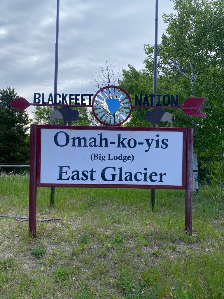
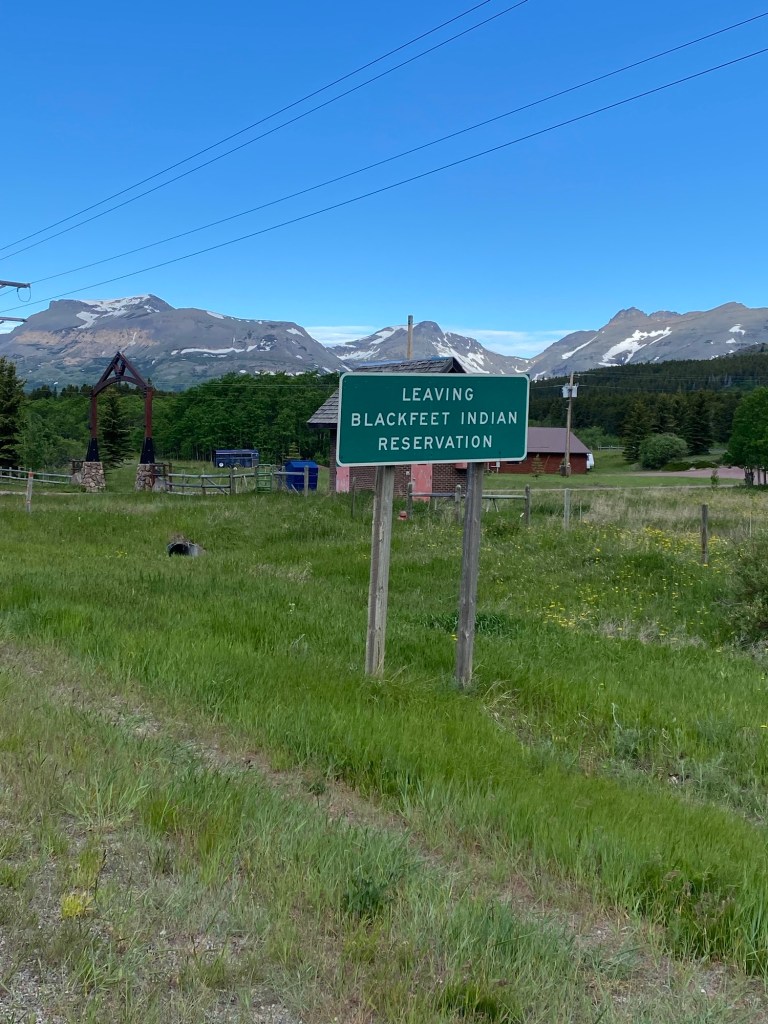
About three miles outside of East Glacier, I reached the boundary of the Blackfeet Nation land. This was a welcome sign and monument for folks headed the other way (east) on Hwy 2, as well as the “goodbye” sign for people heading west like me.
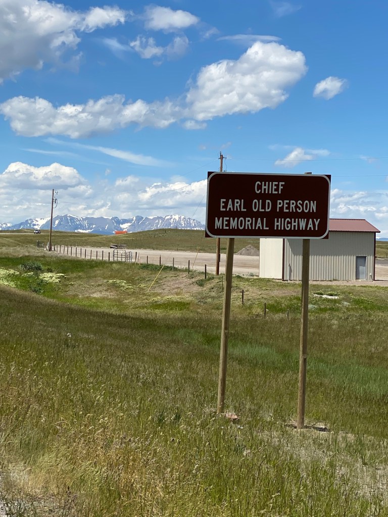
Yesterday afternoon, I had some time to do a little online research on “Chief Earl Old Person,” who was referenced on this stretch of road I saw on Friday. Chief Old Person (“Old Person” was his surname rather than a reference to the chief’s age–his parents also had the surname Old Person) was an honorary lifetime chief of the Blackfeet Nation who lived from 1929 to 2021 and was known throughout the U.S. and the world for his diplomacy and advocacy on behalf of American Indians. He had met all U.S. Presidents from Harry Truman to Barack Obama as well as a number of world leaders.
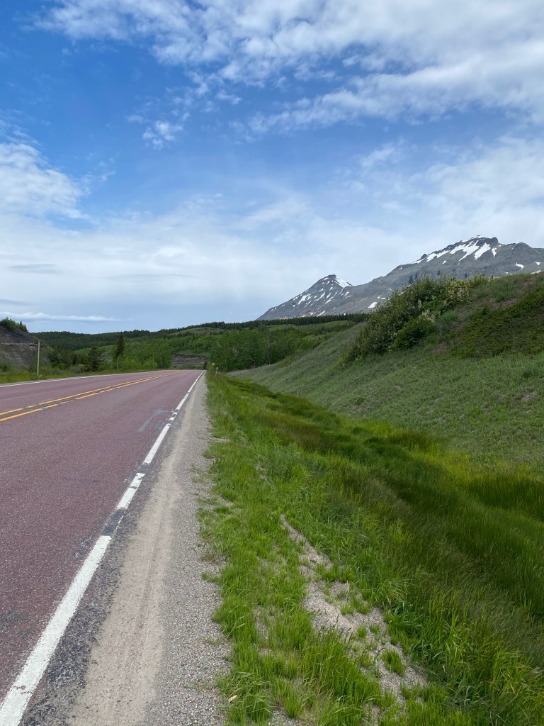
This is what the road to Marias Pass looked like yesterday morning. Yes, there was climbing, but it wasn’t as challenging as I feared it might be. The hill coming out of Browning yesterday was way worse than anything between East Glacier and Marias Pass. The shoulder was narrow, which wasn’t ideal, and there was some traffic, but probably less than there would be later in the day.
I made it to the top of Marias Pass, crossing the Continental Divide, only a couple hours after leaving East Glacier.
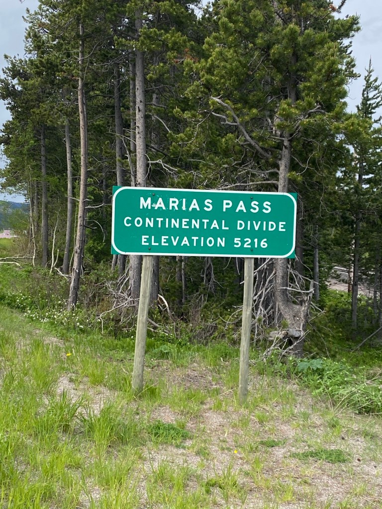
You may wonder where the name “Marias Pass” originated. Marias Wood was the name of Captain Meriwether Lewis’ cousin, and he named Marias River in her honor.
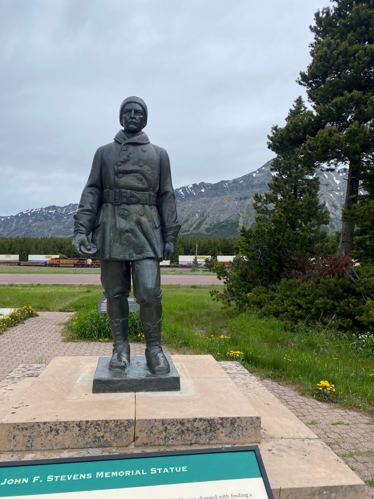
This is a statue of engineer John F. Stevens, who the Great Northern Railway sent to locate the pass, through which railroad Empire Builder James J. Hill hoped to build a rail line to the Pacific Ocean. The effort was successful, and Stevens is credited as the “discoverer” of the pass, even though it had been used by Montana’s Indians long before his discovery. A rail line was built over the pass in 1891.
The road for automobiles through Marias Pass was not finished until 1930, completing the last remaining segment of the Theodore Roosvelt International Highway, which ran from Portland, Maine to Portland, Oregon. Before 1930, motorists on Hwy. 2 had to load their automobiles onto railroad cars to take them through the pass on the Great Northern Railroad.
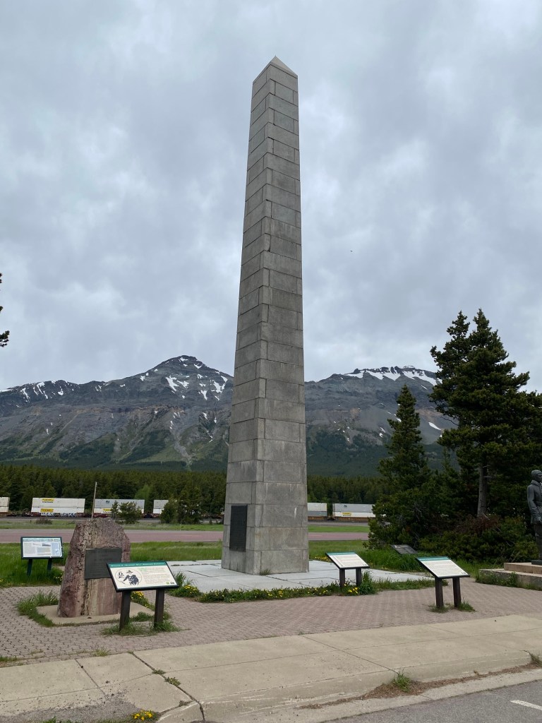
There is an obelisk at Marias Pass which resembles the Washington Monument that honors Theodore Roosevelt for his role as a conservationist. Constructed in 1931, it was originally located in the middle of the Roosevelt International Highway, but in 1989, for safety reasons, it was moved out of the road to its present site a short distance away.
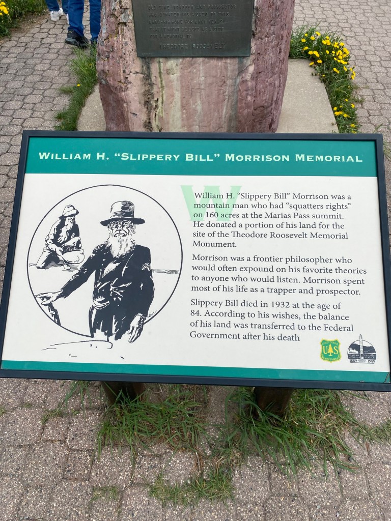
The land for the monument to Roosevelt was donated by a frontier philosopher and mountain man known as William H. “Slippery Bill” Morrison, who owned 160 acres of land at the Marias Pass summit acquired through squatter’s rights. When Slippery Bill died at age 84 in 1932, the remainder of his land was transferred to the Federal Government in accordance with his wishes.
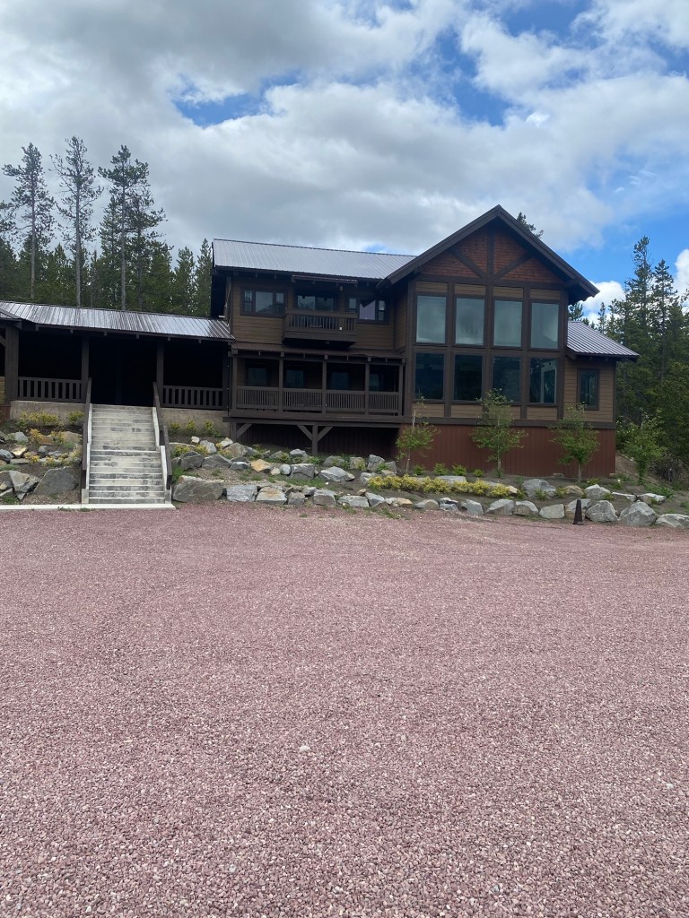
I made it to the lodge/cabins I am staying at both last night and tonight, Summit Mountain Lodge and Steakhouse (located just over the western side of the divide), by mid-morning and was able to check in early–just before it started to rain. I was glad I had gotten an early start.
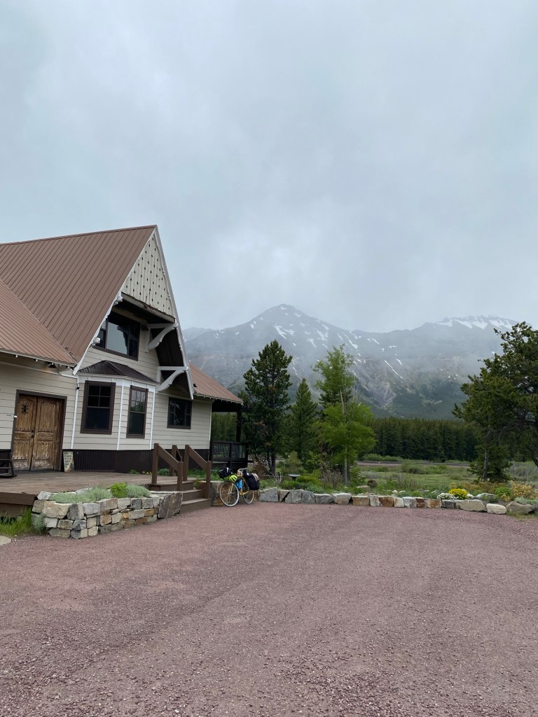
This is the main lodge building, where I’ve been spending a lot of time due to its magnificent view of the mountains as well as its great internet connection.
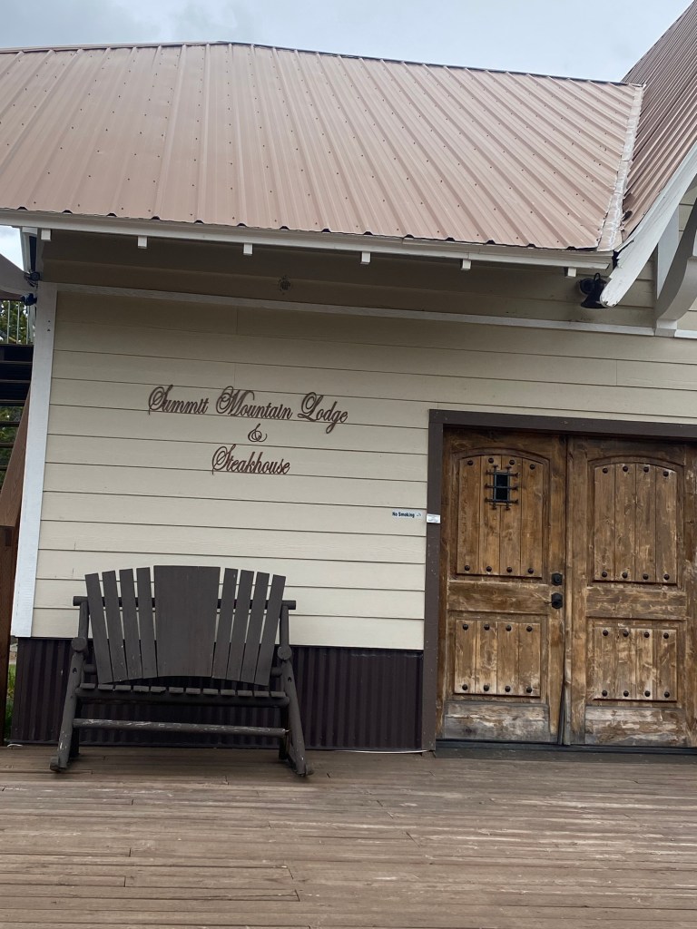
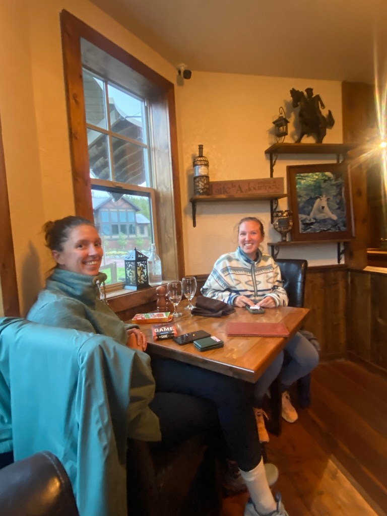
And these are the owners of the Summit Mountain Lodge and Steakhouse, Ted and Marabeth.
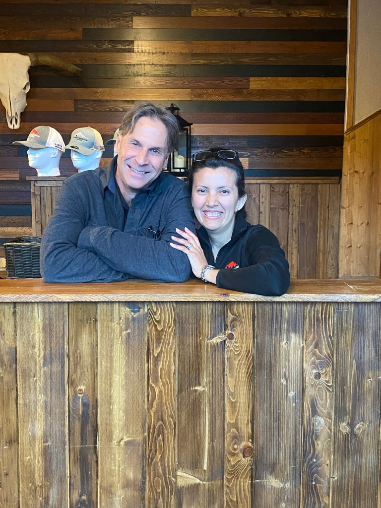
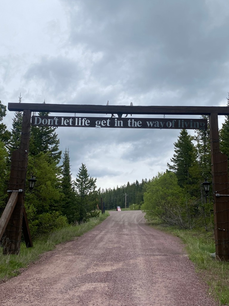
Ted grew up in Montana, loves the outdoors, and used to be a wildlife photographer. Marabeth is from Guatemala. Ted also used to work crazy hours as an emergency room Physician’s Assistant in a leadership role and has lived in a number of countries around the world, including Finland and Sweden. He and Marabeth now seem to be quite at home here at the top of the Continental Divide. I like the motto you see as you are leaving the lodge, “Don’t let life get in the way of living.”
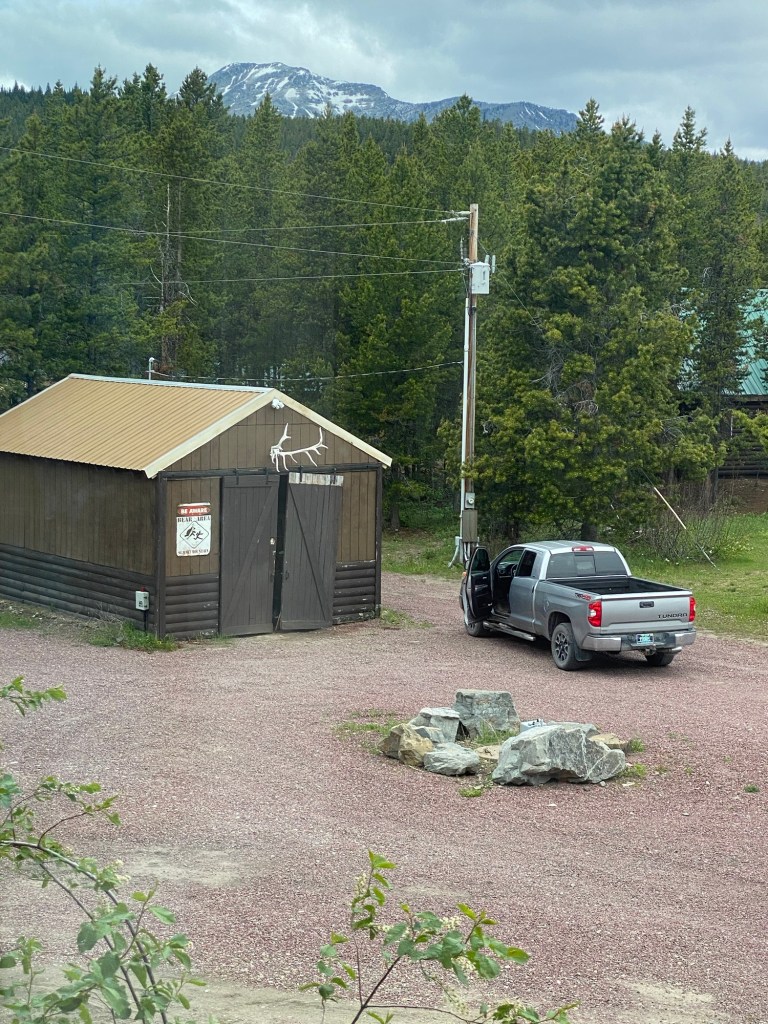
This part of the country gets a lot of snow (more about that shortly). Ted mentioned that by spring, the snow will reach the top of the antlers on this shed. He told me that Going to the Sun Road north of here had drifts up to 80 feet deep this past winter and still has not been completely plowed out.
Of course, I had a steak dinner at the steakhouse last night (fantastic!) and met two women from the Netherlands who were at the next table. One of them, Myrthe (the one on the right), will soon be embarking on a 3,100-mile solo bike trip down the Continental Divide to Mexico.
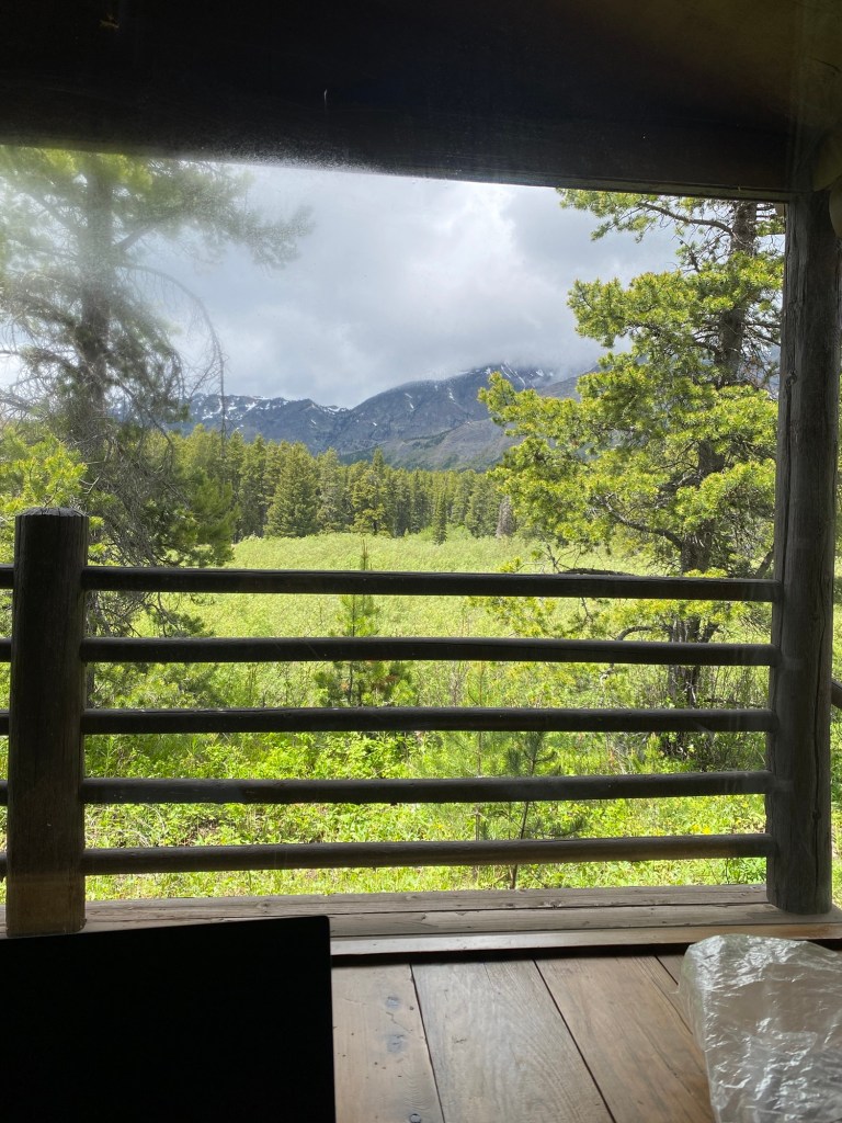
This is the view from my cabin window looking out over the porch. During the course of the day yesterday, my line of sight to the mountains was alternately clear and obscured by storm clouds and fog. No more rain yet today, and I am not doing any biking today.
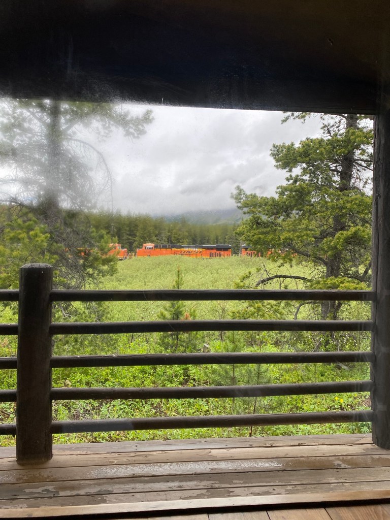
This view from my cabin window shows how close the lodge property is to the train line, which gets a surprising amount of traffic, including both passenger and freight trains. I’ve seen box cars with all kinds of national and international shipping names on them, including “Amazon” and “Cosco.”
I’ve previously alluded to the severe weather in this part of the country. It is really quite extraordinary and volatile. Browning, the community I went through on Friday on my way to East Glacier, holds the world record for the largest temperature change during a 24-hour period. From January 23 to January 24, 1916, the temperature there fell 100 degrees, from 44 degrees Fahrenheit to minus 56 degrees F.
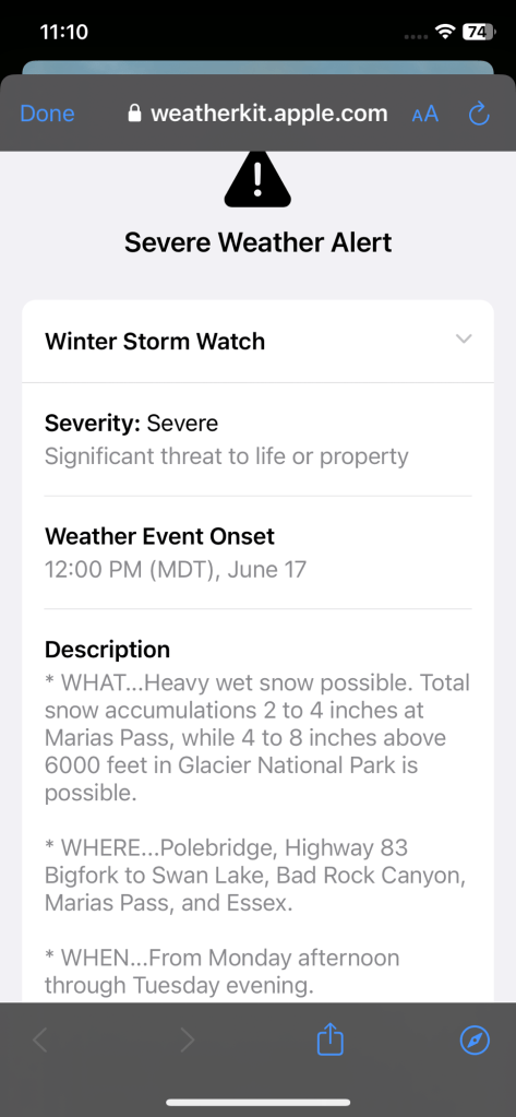
Yesterday (Sat. 6-15), I watched from the comfort of an easy chair at the lodge as the rain turned to sleet and then snow. Although none of the snow collected on the ground where I was, the mountains off in the distance had a more pronounced coating of white following the storm. I am a bit concerned about weather conditions for tomorrow, when I am due to ride 44 miles to West Glacier, MT (pop. 227). Temperatures tomorrow morning are predicted to be as cold as 32 degrees. Here is a weather alert I pulled up a few hours ago:
Now that I am on the west side of the divide, I will be heading mostly downhill (through Essex, about 17 miles away, on my way to West Glacier). Downhills are nice, and I am also told that wind conditions are much better on west side of the mountains. But road bike tires are not optimal for a trip in freezing weather with snow, if that’s what happens. I will be checking the weather closely in the morning.

Leave a comment